Looking for aerial photos of the camp
Posted: Wed Feb 25, 2015 8:20 pm
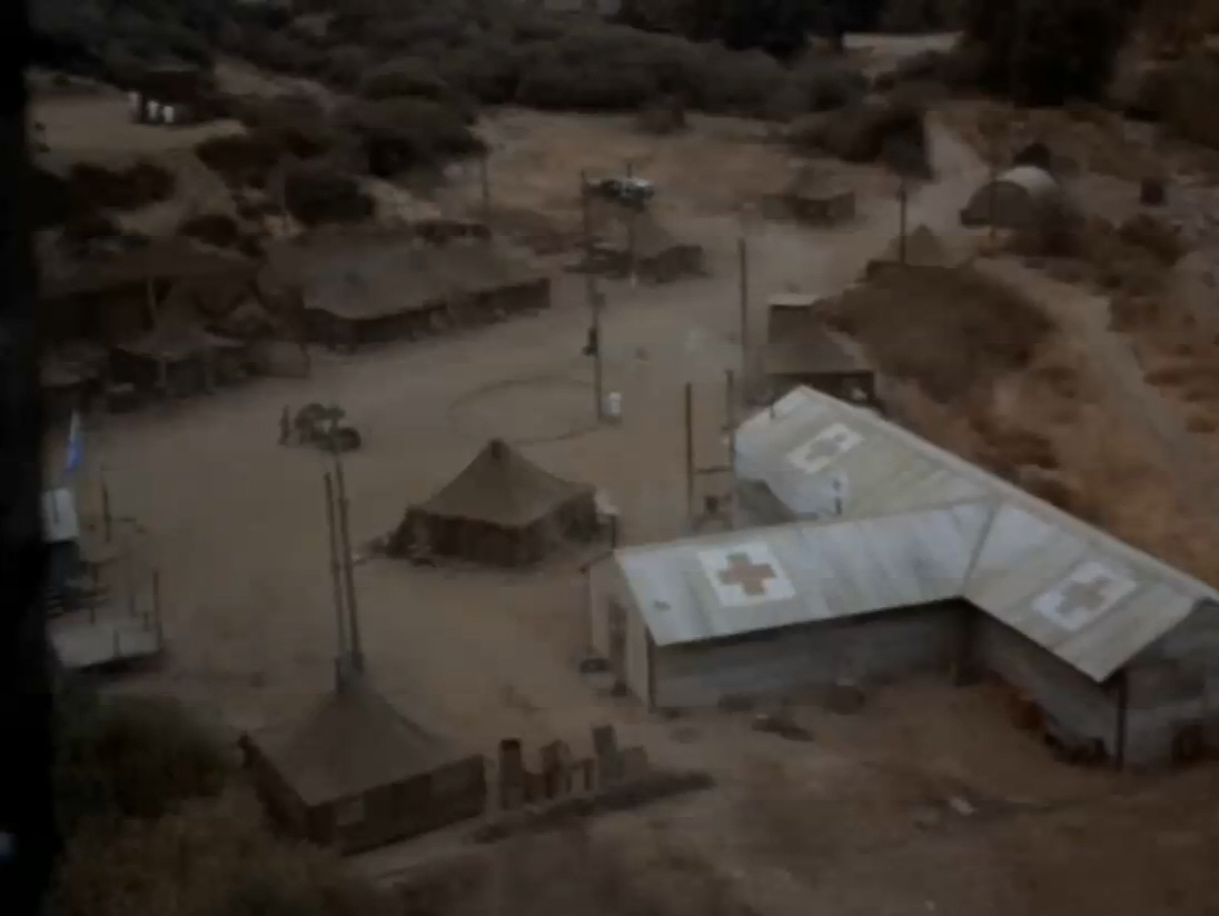
I am looking for aerial photos of the camp before the fire. I am in the process of building a three-dimensional computer model of the actual camp that can be toured via virtual reality.
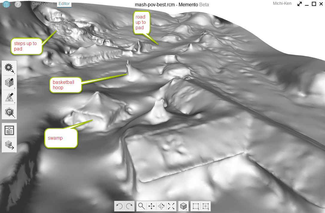
I have found the hand-drawn plans of the camp but unfortunately they are not accurate enough for the 3-D model that I will be building
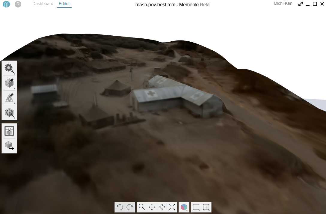
I have already created a digitized model from the sweeping panoramic during the opening credits of the show. I took 30 frames of the animation in the computer generated the tents and buildings. Now I need accurate locations of each of the buildings to put them on Google earth.The Google earth aerial photos only go back to 1989. Ideally I would like to get an aerial photo from high elevation as possible.
Where their episodes that showed the camp from a helicopter view? If I remember correctly there was some sniper scenes that were shot from the helicopter as the machine gun shot the sniper.
I have found the hand-drawn plans of the camp but unfortunately they are not accurate enough for the 3-D model that I will be building
I have already created a digitized model from the sweeping panoramic during the opening credits of the show. I took 30 frames of the animation in the computer generated the tents and buildings. Now I need accurate locations of each of the buildings to put them on Google earth.The Google earth aerial photos only go back to 1989. Ideally I would like to get an aerial photo from high elevation as possible.
Where their episodes that showed the camp from a helicopter view? If I remember correctly there was some sniper scenes that were shot from the helicopter as the machine gun shot the sniper.